v2.9 [May 13, 2016]
Bug Fixes
[GEOS-6146] - Cleanup release data directory configuration
[GEOS-7500] - ImageMosaic creation/update very slow when database has many tables
[GEOS-7513] - Demo Request page testing
[GEOS-7539] - geoserver 2.9RC1 does not start with imagemap extension installed
[GEOS-7544] - Importer FileData use of Resource (rather than File)
[GEOS-7549] - XSS: Reflected Cross Site Script Vulnerability
[GEOS-7554] - GeoServer 2.9 may not start if native JAI is installed in the JDK/JRE
Improvement
[GEOS-4585] - REST API for Module Status (alternative to more parsable status page)
v2.8 [Oct 13, 2015]
Bug
[GEOS-6975] - Multiline Labels are not properly displayed when a translation is applied to a pdf WMS Request
[GEOS-7142] - WCS 2.0.1 can build BoundedBy with wrong axis order
[GEOS-7148] - WCS 2.0.1 can send coverage in wrong format
[GEOS-7181] - New layerGroup via REST ignores styles in a workspace
[GEOS-7187] - Documentation on REST "Resource reset" with errors
[GEOS-7199] - Preview of external graphics in SLD style
[GEOS-7217] - WMS 1.1 Capabilities document does not match DTD - missing Title in style
[GEOS-7226] - Default GML links in Layer Preview page do not work for app-schema layers
[GEOS-7230] - gs:DownloadEstimator should check size is less than Integer.MAX_VALUE
New Feature
[GEOS-7145] - Implementing SLD ShadedRelief
Task
[GEOS-7220] - Document GetFeatureInfo on layergroup
Improvement
[GEOS-7214] - Add scaling support to WPS gs:Download process
[GEOS-7227] - Defer bounds calculation during import
v2.6 [Sep 12, 2014]
Bug fixes:
[GEOS-5149] - WFS 2.0 spatial join failed.
[GEOS-5312] - CSV WFS output format doesn't deal with Windows newlines.
[GEOS-5486] - Poor text with java 7 and Transparency.
[GEOS-6426] - Administration UI does not work properly with Internet Explorer 11.
[GEOS-6685] - WrappedSampleDimension sets NoData category as qualitative.
[GEOS-6686] - MBTiles and GeoPkg are not correctly shown in LayerPreview available formats.
[GEOS-6691] - Geoserver causes a query SELECT NULL AS TABLE_CAT... to be generated by JDBC over and over again.
[GEOS-6692] - multidimensional output in WCS 2.0 only supports WGS84 subsetting.
[GEOS-6693] - Demo request page can product bad urls without slash.
[GEOS-6701] - Provide better error messages when wfs sortby attribute does not exists.
[GEOS-6703] - IOUtils.zipDirectory created zip without directory entries.
[GEOS-6707] - SortBy property name validation breaks app-schema.
[GEOS-6714] - Geoserver Logs page inaccessible.
[GEOS-6719] - Shapefile output format can leak JDBC connections.
[GEOS-6733] - Database performance regression.
[GEOS-6735] - CSSHandler leaves file handles open.
[GEOS-6748] - PointPlacement with Rotation in TextSymbolizer gives NullPointerException.
[GEOS-6750] - Raster rendering might read a row/col less in some cases.
[GEOS-6751] - WFS can OOM when gzipping large compressible output.
[GEOS-6762] - CSW capabilities param/constraints section can grow indefinitely when using a CSW CapabilitiesDecorator.
[GEOS-6763] - polygon.xml generated with reference to default_line.sld.
Improvements:
[GEOS-5034] - Non-advertised layers should appear in the layer-specific virtual service GetCapabilities document.
[GEOS-6603] - Add a button for disabling native warp.
[GEOS-6681] - New REST GET parameter for disabling exception logging when 404 is returned.
[GEOS-6697] - Avoid adding "null" messages in exception reports.
[GEOS-6708] - Allow GeoPkg datastore to create data stores relative to data directory.
[GEOS-6711] - Introduce mapper parameters and webservice based mapper in authkey.
[GEOS-6717] - Improve store param hover labels.
v2.5 [Mar 11, 2014]
Bugs:
- wfs2 resultType=hits maxFeatures returns bad numberMatched
- Assorted CSS documentation glitches
- WMS cascading fails if layers are secured and logging is set to verbose
- Persisters fails writing temporary file
- CAS extension throws exception in case of empty URL params
- Missing user roles if using Authkey Authentication Filter
- VectorRenderingLayerIdentifier will return the same feature multiple times, if there are multiple rules in the SLD matching it
- Unable to get 5x5 test coverage when configuring a layer with footprint in some cases.
- importer cannot handle jagged geojson
Improvement
- ST_Simplify in the PostGIS driver for performance
- Update JNDI tutorial
Task
- Addition of documentation about Footprint management
v2.3 [Mar 14, 2013]
-A couple new authentication options for LDAP, thanks to Mauro Bartolomeoli for this work.
-The file browser used when defining a new data source once again lets windows users explore the available drives
-Alessio has back ported a fix for creating a data sources referencing a shared file system.
-GeoWebCache has fixes for WMS 1.3.0 and database security (thanks to Jonathan Moules for reporting this one).
v2.2 [Aug 8, 2012]
Fixes:
- [GEOS-5157] – Can’t configure MediaType in INSPIRE extension
- [GEOS-5376] – Line sizes with UOM in legend decoration are doubly scaled when using DPI
- [GEOS-5377] – WMS GetFeatureInfo fails when post filter required
- [GEOS-5388] – Confusing ‘Bad credentials forroot’ exception in verbose_logging mode when logged in as admin or root
- [GEOS-5395] – Catalog reload breaks GWC integration, update sequence upgrade and namespace/workspace consistency
- [GEOS-5402] – Subclasses of GeoServerPreAuthenticationFilter do not map local admin roles to global admin roles
- [GEOS-5366] – Better heuristic for OWS Request filenames
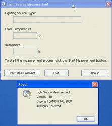
This is the tool to measure light source using i1 series products from X-Rite.

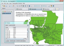
Combines geometries using the spatial methods STDifference, STIntersection, etc.